


Mobile Civic Center, Mobile County, Alabama
About
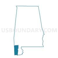
Outline

Summary
| Unique Area Identifier | 522612 |
| Name | Mobile Civic Center |
| County | Mobile County |
| State | Alabama |
| Area (square miles) | 5.46 |
| Land Area (square miles) | 3.04 |
| Water Area (square miles) | 2.42 |
| % of Land Area | 55.70 |
| % of Water Area | 44.30 |
| Latitude of the Internal Point | 30.66704050 |
| Longtitude of the Internal Point | -88.03566680 |
Maps


Graphs
Select a template below for downloading or customizing gragh for Mobile Civic Center, Mobile County, Alabama


Neighbors
Neighoring Voting District (by Name) Neighboring Voting District on the Map
- Bishop St Community College, Mobile County, AL
- Bromley Crossroads Vol. Fire Dept. Substation, Baldwin County, AL
- Daphne Civic Center, Baldwin County, AL
- Elk's Lodge #108, Mobile County, AL
- Rock of Faith Baptist Church, Mobile County, AL
- Springhill Avenue Recreational Center, Mobile County, AL
- St Joan Of Arc Catholic Church, Mobile County, AL
Top 10 Neighboring County Subdivision (by Population) Neighboring County Subdivision on the Map
Top 10 Neighboring Place (by Population) Neighboring Place on the Map
Top 10 Neighboring Unified School District (by Population) Neighboring Unified School District on the Map
Top 10 Neighboring State Legislative District Lower Chamber (by Population) Neighboring State Legislative District Lower Chamber on the Map
Top 10 Neighboring State Legislative District Upper Chamber (by Population) Neighboring State Legislative District Upper Chamber on the Map
- State Senate District 32, AL (155,619)
- State Senate District 35, AL (126,686)
- State Senate District 33, AL (111,915)
Top 10 Neighboring 111th Congressional District (by Population) Neighboring 111th Congressional District on the Map
Top 10 Neighboring Census Tract (by Population) Neighboring Census Tract on the Map
- Census Tract 107.05, Baldwin County, AL (8,331)
- Census Tract 74, Mobile County, AL (3,647)
- Census Tract 12, Mobile County, AL (3,484)
- Census Tract 11, Mobile County, AL (2,244)
- Census Tract 10.02, Mobile County, AL (2,176)
- Census Tract 10.01, Mobile County, AL (2,058)
- Census Tract 2, Mobile County, AL (1,416)
- Census Tract 9900, Mobile County, AL (0)